EARTHQUAKE
WATCH
- Hazard Details
- UPDATE
- USGS
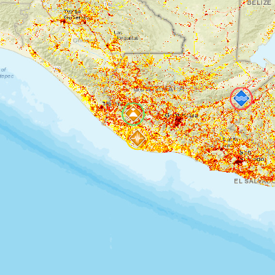
- 11km SW of Pueblo Nuevo Tiquisate, Guatemala
June 15, 2016 14:24:58 GMT
June 15, 2016 13:46:57 GMT
June 15, 2016 14:26:00 GMT
USGS PAGER
-
Image: Population per 1 sq km from Landscan. Click image for full view.

Chart: Percent Chance of Estimated Fatalities
Chart: Percent Chance of Estimated Economic Losses in USD (Millions)
Other Resources / Information